Journey to the South Pole: NASA releases stunning images revealing the incredible beauty of the Antarctic
These dramatic images taken aboard Nasa's Operation IceBridge research aircraft show the icy beauty of the Antarctic in stunning detail.
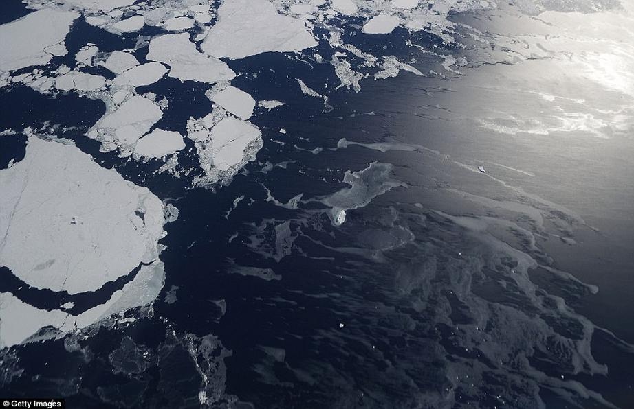
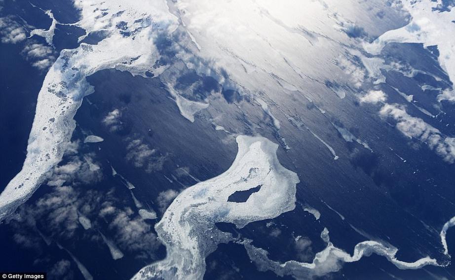
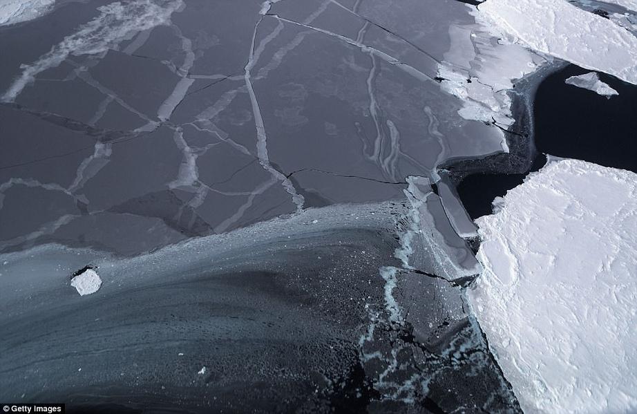
The images include sweeping shots of mountains and land ice, carpets of icebergs spreading from the Antarctic coast, and even a snap of a researcher taking a rest during a return flight.
Operation IceBridge has been studying how polar ice has evolved over the past nine years and is currently flying a set of nine-hour research flights over West Antarctica to monitor ice loss.
The mission, which uses a retrofitted 1966 Lockheed P-3 aircraft, is now targeting 'sea ice in the Bellingshausen and Weddell seas and glaciers in the Antarctic Peninsula and along the English and Bryan Coasts,' Nasa said.
Researchers have used the IceBridge data to observe that the West Antarctic Ice Sheet may be in a state of irreversible decline directly contributing to rising sea levels.
The National Climate Assessment, a study produced every four years by scientists from 13 federal agencies of the US government, released a stark report November 2 stating that global temperature rise over the past 115 years has been primarily caused by 'human activities, especially emissions of greenhouse gases'.
For almost a decade, Nasa's Operation IceBridge has been on a mission to build a record of how polar ice is evolving in a changing environment. Nasa has released a series of stunning images revealing what it believes is a huge extent of loss at the south pole
Operation IceBridge's mission is to collect data on changing polar land and sea ice and maintain continuity of measurements between ICESat missions. The original ICESat mission ended in 2009
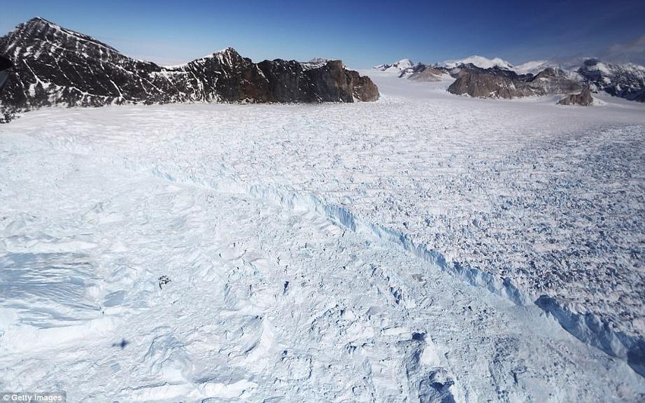
Shown here is an image taken Operation IceBridge research aircraft in the Antarctic Peninsula region, on November 4 above Antarctica. Researchers are currently flying a set of nine-hour research flights over West Antarctica to monitor ice loss
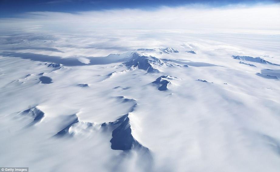
In this image, a series of mountains and land ice are seen from NASA's Operation IceBridge research aircraft in the Antarctic Peninsula region
For the rest of this article and video, please use source link below.