Heatwave melts Antarctic island
Islands in Antarctica aren’t supposed to look like this. A heatwave is seeing temperatures soar and snow melt at a frightening rate.
A nine-day heatwave in Antarctica has melted more than 20 per cent of the seasonal snowfall on one island after the continent recorded its highest temperature ever.
New images released by NASA’s Earth Observatory show the transformation, as record temperatures melt the ice away, revealing bare earth and creating new ponds on the island.
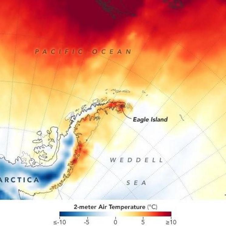
From February 5 until February 13, Antarctica was hit with a heatwave that set a new record, with an 18.3C day detected at the Esperanza Base on the northern tip of the Antarctic Peninsula on February 6.
On that day 30mm of ice melted on Eagle Island, on its way to a total of 106mm by February 11.
That accounts for around 20 per cent of the total snow that accumulated on the island during the season.
Satellite images from NASA’s Landsat 8 satellite using its Operational Land Imager shows the extent of the melting during the period.
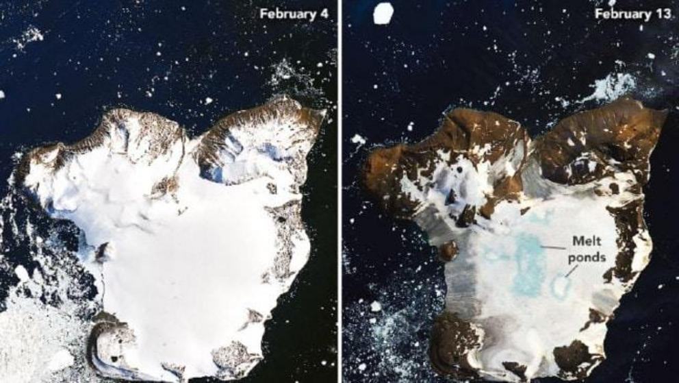
A composite of two satellite images shows the extent of the ice melt. Picture: NASASource: Supplied
Nichols College glaciologist Mauri Pelto said this kind of melting wouldn’t usually happen in Antarctica, and the persistent and sustained increase in temperatures wasn’t typical until recently.
“I haven’t seen melt ponds develop this quickly in Antarctica,” Dr Pelto said.
“You see these kinds of melt events in Alaska and Greenland, but not usually in Antarctica.”
He also observed widespread melting on the nearby Boydell Glacier.
According to NASA, the increased temperatures at the start of February were caused by a combination of elements including a high-pressure system that allowed warm temperatures to build and a usual system of strong winds that circle the continent being weaker than usual.
Sea surface temperatures were also 2-3C above average.
It's been hotter than usual more often. Picture: NASASource: Supplied
Foehn winds cause gusty windstorms on mountains that send dry, warm air down them.
The drier air also means fewer clouds, which means more direct sunlight.
The latest melt event was the third of the 2019-2020 summer according to NASA, with major melt events also occurring after heatwaves in November last year (which is technically spring) and January.
Dr Pelto said the increased frequency of the events was the real cause of concern, rather than the latest melt event.
“If you think about this one event in February, it isn’t that significant. It’s more significant that these events are coming more frequently,” Dr Pelto said.