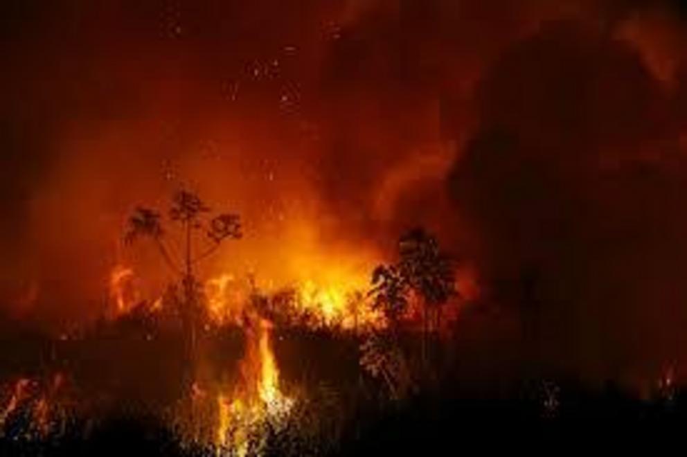
‘Devastating’ fires engulf Brazilian Pantanal wetlands – again
- Wildfires erupting in August have ravaged much of Brazil’s Pantanal Matogrossense National Park, which is a part of the Pantanal region, the world’s largest tropical wetland.
- Fires have so far consumed nearly 4.5 million hectares across the Pantanal, totaling about 30% of the biome and nearly 22 times the area lost between 2000 and 2018.
- This year’s intense fires added to damage already done in 2019, when flames engulfed hundreds of thousands of hectares across the Pantanal.
- Sources say most of the fires started from slash-and-burn farming, which is becoming more prevalent due to the weakening of environmental agencies under the Bolsonaro administration.
Under the thick blanket of smoke, relentless flames spread with dizzying speed over swaths of Pantanal Matogrossense National Park, its grasslands parched by months of drought. In a charred marshland, the carcass of a crocodile-like caiman lays sprawled on its back. Beyond, ash and burnt shrubs stretch for miles across this protected slice of the Brazilian Pantanal.
Wildfires have been ravaging Pantanal Matogrossense National Park for months, invading the vast conservation area from all sides, according to local sources. The blazes have wreaked untold environmental havoc on this rich and complex ecosystem, scorching vegetation, killing animals and leaving countless others without habitat.
“The extent of the damage is devastating,” said Vinicius Silgueiro, territorial intelligence coordinator at Instituto Centro de Vida (ICV), a Cuiaba-based sustainability nonprofit whose work has been focused on the Pantanal fires. “It’s an impact that is impossible to fully understand yet – but we know it has disrupted the equilibrium in a profound way.”
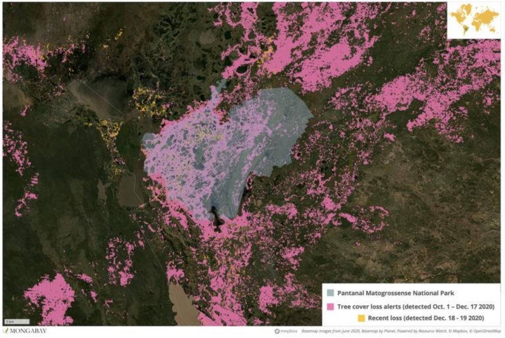 Satellite data show huge areas of tree cover loss in Pantanal Matogrossense National Park following the latest spate of wide-ranging, out-of-control wildfires.
Pantanal Matogrossense National Park encompasses some 135,000 hectares across the municipality of Pocone in the Brazilian state of Mato Grosso. The area has been under federal protection for nearly four decades, with entry into the park strictly restricted in a bid to shield its rich ecological diversity.
The park is a part of the Pantanal region, the world’s largest tropical wetland, sprawling nearly 210,000 square kilometers (81,000 square miles) across Brazil, Bolivia and Paraguay. In Brazil, it stretches across the western states of Mato Grosso and Mato Grosso do Sul. It is home to the world’s second largest population of jaguars and provides habitat for dozens of species threatened with extinction, like the hyacinth macaw (Anodorhynchus hyacinthinus).
Normally, the Pantanal is drenched by heavy rains between October and April, which flood about 80 percent of the region, turning it into a maze of marshes and streams. But a prolonged drought has spelled disaster for the region, with searing temperatures and high winds making the parched land highly susceptible to fires.
“The dry season this year was really extreme,” Silgueiro said. “And it created the perfect conditions for the fires. The vegetation became really vulnerable to catching fire.”
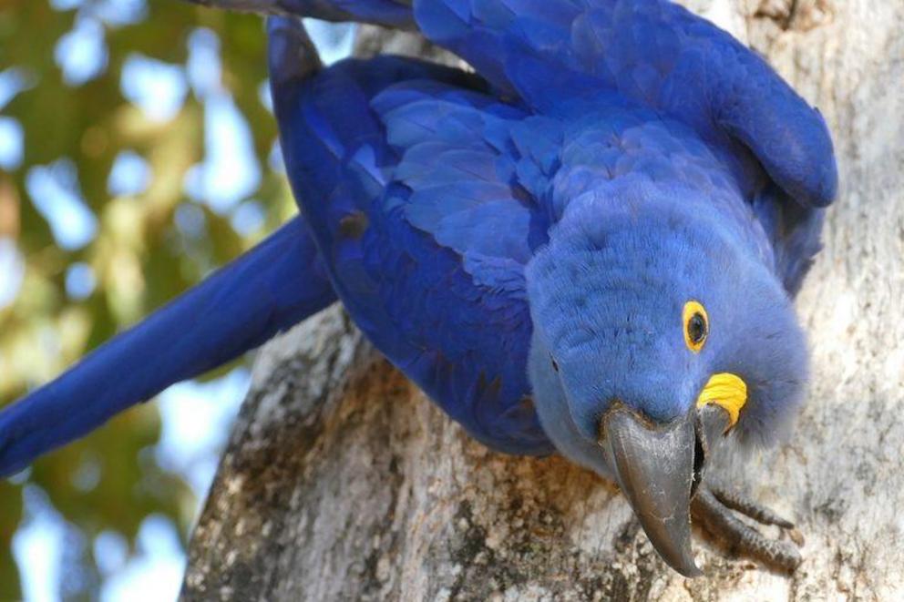 Hyacinth macaws (Anodorhynchus hyacinthinus) are the largest flying parrots in the world. They’re listed as Vulnerable by the IUCN and exist predominantly in only three isolated populations in South America – one of which is in the Pantanal.
Fires have so far consumed nearly 4.5 million hectares – totaling about 30% of the Pantanal biome, according to Cássio Bernadino, Pantanal conservation analyst at WWF Brazil. This is nearly 22 times the area lost between 2000 and 2018, the Brazilian Institute of Geography and Statistics (IBGE) estimates. This year’s intense fires added to damage already done in 2019, when flames engulfed hundreds of thousands of hectares across the Pantanal.
“The situation in the Pantanal has been an unprecedented disaster,” Bernadino said. “We still don’t know the extent of the impact on the fauna and flora. But, without a doubt, there was a significant loss of wildlife. It really is a calamity.”
In Mato Grosso, fires have burned through about 40% of the state’s Pantanal region, according to NASA data analyzed by ICV. In Pocone – home to Pantanal Matogrossense National Park – satellites from U.S. space agency NASA recorded more than 1.82 million fire alerts between Sept. 28 and Dec. 20, a huge jump from the same period last year.
In Pantanal Matogrossense, local sources say intense fires have been burning since at least August, with flames engulfing huge swaths in the northern, northeastern, eastern, southern and western regions of the vast conservation area.
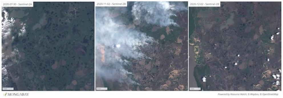 Satellite imagery shows fires spreading across Pantanal Matogrossense National Park in early November 2020.
Even the arrival of rains in recent weeks has provided little relief: as of Dec. 17, the southwest region of the park and its northern fringe were still burning, according to an environmental agency source who asked to remain anonymous as he is not permitted to speak to the media.
“The park was surrounded by fires on all sides,” the source said. “And it’s a huge region, with very complicated access, so it’s been very difficult to control the fires. They’ve burned out of control.”
Manmade disaster
Natural wildfires are not uncommon in the Pantanal during wetter months, when lightning storms can easily set ablaze the peat soil, which is made up of layers of highly-combustible decomposed organic matter. But environmental and enforcement sources say the vast majority of the fires raging this year can be traced back to human activity, rather than nature.
In Mato Grosso, where livestock is a key economic driver, cattle ranchers often set degraded pastures ablaze in a bid to renew them. Some traditional communities also use fire to clear small plots of land for subsistence farming or cultural rituals. Meanwhile, speculators seeking to expand their agricultural land holdings routinely set nearby plots ablaze in a bid to clear and claim them, local sources say.
Some 98% of the fires in the Pantanal this year can be traced back to human activity, according to Silgueiro. In Pantanal Matogrossense, three of the five major fires that have swept through the area are believed to have started on farms outside the park and burned out of control, according to the environmental agency source.
“Very few of these fires started because of natural causes,” Silgueiro said. “The fire that spread and entered into the national park also came from outside. And it ended up burning out of control and entering this conservation unit.”
Slash-and-burn agricultural blazes are technically only permitted during the rainy season, with authorization from the state secretariat for the environment. During the dry months, when fires are more likely to run out of control, agricultural burning is prohibited altogether. But in reality, the ban is not always respected and enforcement is haphazard, according to environmental sources.
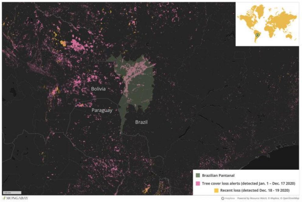 The Pantanal wetland stretches across parts of Brazil, Bolivia and Paraguay, with the lion’s share in Brazil.
Many of these fires spread out of control with unprecedented speed this year, fueled by a historic drought in the Pantanal. The region saw its lowest level of rainfall in nearly half a century in 2020 and the lack of rains badly depleted the Paraguay River, one of the most important rivers in the region. Out-of-control fires were ripping through the region even in January and February, usually the wettest months.
“The vegetation is really dry; the Pantanal didn’t flood this year,” the environmental agency source said. “Areas that normally don’t catch fire because they are always flooded, this year they were totally dry, so they burned completely.”
Late response
Federal and state forces have been battling the fires in the Pantanal for months, but getting the flames under control has proven a challenge. In Pantanal Matogrossense, agents from ICMBio and Ibama – Brazil’s two federal environmental agencies – have been working alongside the military, the navy, civil defense forces and state fire brigades to battle the flames, according to the environmental agency source.
But their efforts have been marred by soaring temperatures and gusty winds, which have made it that much more difficult to combat the flames. Meanwhile, lack of access to large swaths of the remote park has further complicated efforts to bring the blazes under control.
“It was really difficult to fight the flames, the spread of the fire was very aggressive,” the enforcemental agency source said. “There was a lot of wind and extremely high temperatures. And the vegetation is really dry. Access is difficult, too; it’s only possible to reach some parts of the park with a helicopter.”
The unique way in which fires burn in the Pantanal has also posed a challenge. While in other regions of Brazil – including the Amazon – blazes engulf vegetation and trees, fires in the Pantanal tend to burn just below the surface of the earth, fueled by peat. These low-intensity fires can burn for longer and are often particularly difficult to extinguish.
Mato Grosso state has doubled down on its efforts to combat the fires this year, employing a new monitoring system for the first time this season – but still struggled to control the flames. Faced with the surge in fires, the state declared a state of emergency in mid-September, which allowed authorities to allocate even more resources to combatting the flames. The federal government also employed its military to combat the fires in the Amazon and the Pantanal, in a costly operation dubbed Green Brazil II.
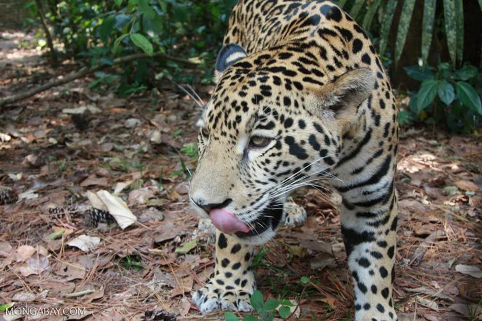 The Pantanal is home to the home to the world’s second largest population of jaguars (Panthera onca).
In a bid to curb slash-and-burn fires, the federal government moved to impose a moratorium on the use of fire for agricultural purposes across the Pantanal and the Amazon in July, while Mato Grosso state also instated its annual ban earlier this year.
But critics say that the measures taken by federal and state authorities came too late to curb the destruction in the Pantanal. Despite signs early this year that signaled an intense fire season ahead, Bernadino noted there was a lack of preparation by federal authorities, making it more difficult to control the blazes.
“These actions are important,” he said. “But there was a late mobilization of resources … Controlling fires of this magnitude requires massive resources. Unfortunately, the actions taken did not reach the scale necessary to control the situation.”
Environmentalists also say friendly signals by the federal government are encouraging agricultural burning and creating a climate of impunity. President Jair Bolsonaro has routinely railed against environmental protections and has made repeated comments undermining attempts by Brazilian courts to roll out harsher punishment for criminal burning, land-grabbing and deforestation.
.
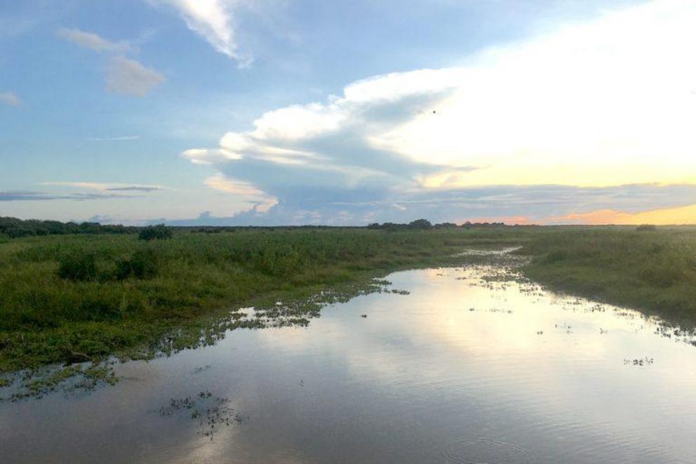 The Pantanal on a better day
Under Bolsonaro’s leadership, the capacity of federal agents to combat forest fires has also been hit hard. Ibama, Brazil’s main environmental enforcement agency, has seen its funding slashed dramatically on Bolsonaro’s watch, which has curbed the scope of its fire brigade scheme, Prevfogo. Weak enforcement of environmental laws, meanwhile, has meant that perpetrators of illegal burning and deforestation often face few consequences.
“The weakening of environmental agencies ends up giving a green light to this activity,” Silgueiro said. “Because, for those who are using fire or deforesting, they don’t worry about getting a fine, they don’t worry that they will be held responsible. So it sends a message that nothing will happen to whoever does this.”
While the worst of the fires may be over for now, a weak start to the rainy season is fueling worries that more drought and destruction may lie ahead for the Pantanal. WWF’s Bernadino noted that 2021 is expected to bring “a large number of fires, given the drought of the Paraguay River, the observed trend towards high temperatures and the persistent human activity.”
The impact of this year’s unprecedented fires is not yet clear but environmentalists say the Pantanal will likely be reeling from the damage for decades. The fires have been ecologically devastating, potentially wiping out rare species of animals and leaving others without habitat. They have also devastated traditional and indigenous communities living in the region, reducing their crops to ashes and destroying their livelihoods.
“Some areas will be able to recuperate quickly,” Silgueiro said. “But others will struggle to recover. It may be a very long time before we see the same diversity that these areas once had.”
Editor’s note: This story was powered by Places to Watch, a Global Forest Watch (GFW) initiative designed to quickly identify concerning forest loss around the world and catalyze further investigation of these areas. Places to Watch draws on a combination of near-real-time satellite data, automated algorithms and field intelligence to identify new areas on a monthly basis. In partnership with Mongabay, GFW is supporting data-driven journalism by providing data and maps generated by Places to Watch. Mongabay maintains complete editorial independence over the stories reported using this data.

