
New SAR Scans reveal a second Sphinx on Giza Plateau
New SAR Scans Reveal a Second Sphinx on Giza Plateau
Jul 09, 2026
A stele is like an ancient Egyptian billboard. Pharaohs used them to record major events, announce their deeds, and communicate with the public. The “Dream Stele” is a large stone slab, 4.2 meters tall, made of granite. It was carved with hieroglyphs around 1400 B.C. during the reign of Pharaoh Thutmose IV of the 18th Dynasty, who had it placed between the paws of the Great Sphinx of Giza as the back wall of a small chapel he built there. It was later buried under sand where it remained for centuries before being rediscovered in 1818 by Giovanni Battista Caviglia.
According to the inscription, a young prince Thutmose was out on a hunting expedition near the pyramids when he grew tired and lay down to rest in the shade of the Great Sphinx’s massive head, which at the time was buried up to its neck in sand. Thutmose then had a dream that the Sphinx, speaking as the sun god, promised him the throne of Egypt if he would excavate the Sphinx from the desert sands. Thutmose did so, and was rewarded with the kingship. The Dream Stele is generally believed to be a piece of propaganda designed to legitimize Thutmose’s rule. Historical evidence suggests Thutmose IV may not have been the intended heir. His older brothers who would have had a stronger claim to the throne mysteriously vanished from history, and their names were removed from other monuments.
The Dream Stele shows two sphinxes, and while the official argument is that this is a standard convention in Egyptian art used to emphasize the importance of a divine entity through duplication, others have argued that it is a literal depiction and that a second sphinx exists, or had existed, somewhere on the Giza Plateau.
Based on the equinoctial alignments observed on the Giza Plateau, as well as historical and religious indicators, researcher Damiano Piras hypothesized the existance and location of a second sphinx. He published his methods and findings in the book, The Dawn of a New Sphinx.
Last year, researchers Filippo Biondi and Corrado Malanga, famously announced their discovery of massive underground structures beneath the Giza Plateau in Egypt, over 700 meters deep. This research was primarily done using SAR (Synthetic Aperture Radar) Doppler tomography. In simple terms, this is a way of seeing underground using radar from satellites or aircraft. Radar waves are cast down to the Earth’s surface, where they record signals, and are then bounced back. By using multiple passes over the same area, the system creates high-resolution images that can detect millimeter-scale movements. By combining these scans with complex computer processing, scientists create 3D models made up of slices known as “tomograms” that illustrate what lies beneath the surface. It’s much like a medical CAT scan on a grand scale. This technology is excellent for mapping large features and can identify density differences underground.
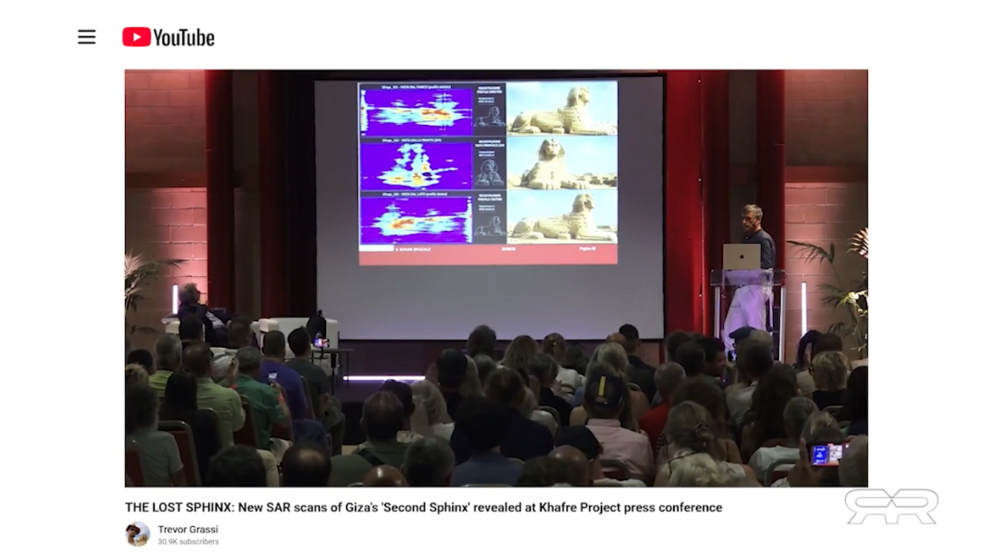
At a recent conference in Bologna, Italy, Filippo Biondi and Corrado Malanga presented their latest findings in their “Coffer Research Project.” Once again, using SAR Doppler tomography to scan an area on the Giza Plateau, they have found what appears to be a buried Sphinx-shaped structure. The SAR scans show the outline of a sphinx that mirrors the one on the surface. It has the same body, head, and paws, with the same intact Uraeus cobra, which was removed from the Great Sphinx on the surface, on its forehead. It appears to be the same size and shape of the Great Sphinx on the surface, and it is exactly where Damiano Piras hypothesized it would be. The scans also reveal the same vertical shafts and passages found beneath the pyramids and the entire plateau seen in their previous work.
To counter claims of “pareidolia,” seeing patterns where none exist, the researchers used AI to analyze the scans. The AI gave high probabilities, ranging from 78% to 96.5%, that the structures were indeed a sphinx-like monument, not a natural formation.
The research team plans to submit a proposal to Egyptian authorities to excavate the site, which was covered by a 108-foot mound of sand in the 1920s. This area was known as the Western Cemetery and was recognized as a burial ground for high-ranking nobles, but for some reason, became a garbage dump for material excavated from other areas on the plateau.