Largest known early map of the world
Collectors assemble the largest known early map of the world: Misshapen countries, mythical creatures, and illustrations of kings revealed in stunning 10 FOOT map from the 16th century
- Map was made in 1587 by cartographer Urbano Monte
- It has remained bound as an atlas for over 400 years
- Experts scanned and digitally joined its 60 pieces
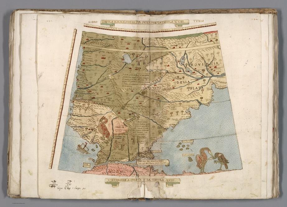
A massive 16th century map made up of 60 individual sheets has been assembled for the first time, after more than 400 years bound as an atlas.
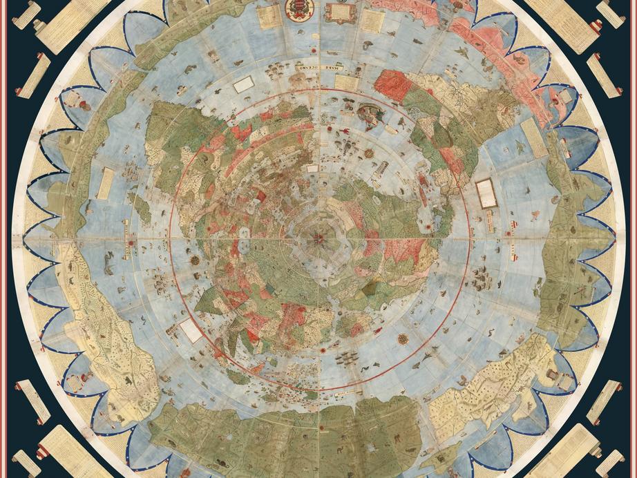
The remarkable map is said to be the largest of its kind, and was created in 1587 by Urbano Monte.
Experts at the David Rumsey Map Center at Stanford Libraries, where the original is now bring housed, have digitally joined its many separate pieces, revealing stunning illustrations of the continents, oceans, and even mythical creatures.
The enormous ‘planisphere,’ which stretches more than nine feet by nine feet in its entirety, also contains numerous examples of the geographical misconceptions of the time, National Geographic reports.
© Courtesy, David Rumsey Map Collection, davidrumsey.com
The map views Earth from the perspective of someone looking directly down on the North Pole, with this point being the central focus
The experts say it’s the largest known early map of the world.
To assemble it in the digital format, map collector David Rumsey worked with his nephew to painstakingly scan each of the 60 pages.
The ancient world map contains detailed illustrations of animals, mermen, unicorns, and sailors traveling the seas.
One image, for example, shows King Philip II of Spain riding a vessel on which his throne is perched.
While geographical knowledge since Monte’s map has vastly developed, the experts say many of the ideas he included in the design were advanced.
The ancient world map contains detailed illustrations of animals, mermen, unicorns, and sailors traveling the seas. One image (shown above) shows King Philip II of Spain, riding a vessel on which his throne is perched
More images at source link below
For the rest of this article please go to source link below.
For full references please use source link below.