Cutting-edge laser technology uncovers secrets of Maya holy city
Over the last few years, Global Conservation has been involved in the deployment of new technology that is revolutionizing archaeology. With our support, scientists from the Mirador Basin Project have used the Light Detection and Ranging Tool, known as LiDAR, to uncover thousands of ancient Maya temples, pyramids and city complexes deep in the jungles of the Maya Biosphere Reserve, Guatemala.

Project leader Richard Hansen with the LiDAR system.
This new LiDAR mapping technology works by sending laser pulses from a small airplane. These lasers are able to penetrate the forest canopy at a rate of 560,000 points per second and bounce off of the ground below. When these laser pulses return to the plane-mounted computer, it generates a 3-D topographical map of the ancient cities under the forest canopy.

The LiDAR system was mounted on this small plane.
Mirador Basin Project scientists, under the leadership of Dr. Richard Hansen of the Foundation for Anthropological Research and Environmental Studies (FARES), have scanned and analyzed over 700 square kilometers of the Mirador rainforest. With this LiDAR technology, we have been able to prove the incredible size and complexity of transport “superhighways”, revealing that the Maya rivaled the ancient Romans in road construction skills.
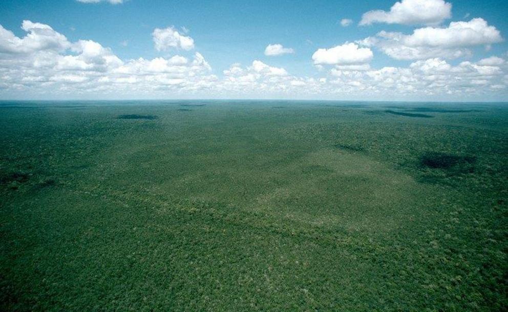
El Mirador from the air. Without LiDAR to penetrate the dense rainforest canopy, this area simply looks like a vast expanse of wilderness. A straight line through the trees in the lower third of the image hints at the massive, ancient causeway below. Only with LiDAR could scientists begin to understand the true extent of the ancient city (below).
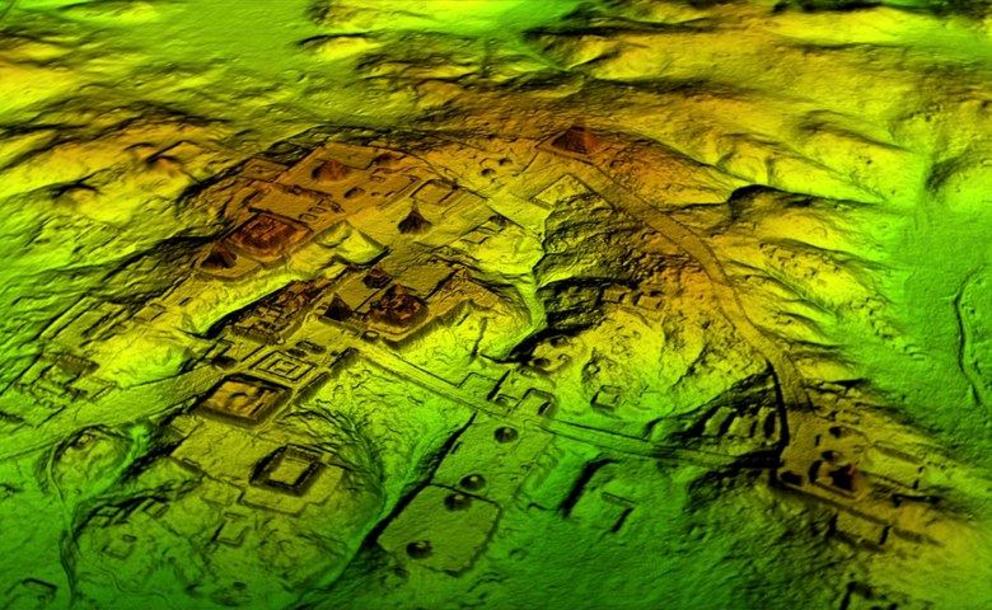
A three-dimensional rendering of the ancient city of El Mirador, produced from LiDAR data. To the naked eye, this area simply looks like a vast expanse of rainforest (above). Image courtesy Mirador Basin Project.
Hidden beneath the tangled rainforest, the 2,000-year-old road network stretches across 240km, with the ancient ruins of El Mirador at its center. Probably dating back to around the 6th century BCE, El Mirador was the heart of Maya civilization around the early first century CE, when it had a population of as many as a quarter of a million people and built some of the largest pyramids in the world.
The people of Mirador dramatically altered their landscape, creating complex systems of irrigated terraces for intensive agriculture. Two massive causeways, used for freight transport, are up to 40km long, 6m high, and 45m wide, wider than a modern 10-lane highway. Though the roads have been known since 1967, the thick rainforest obscured their extent. These causeways may indicate that food production existed on an industrial scale in El Mirador.
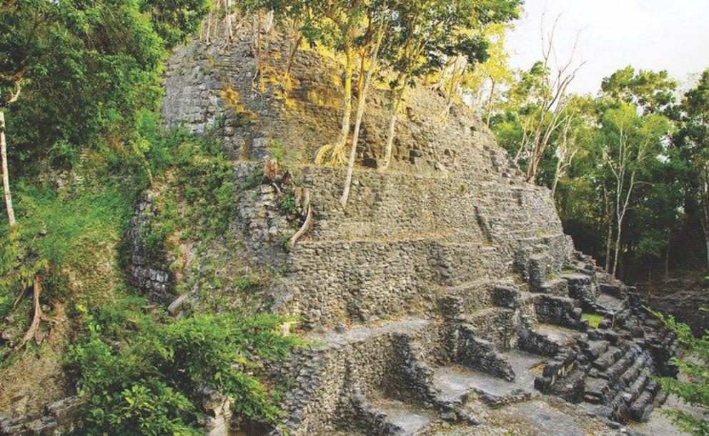
The summit of La Danta, which some archaeologists consider to be the largest pyramid in the world. Only the top 24m are exposed; the remaining 46m have been buried underground over the course of nearly two millennia. Future work will expose one side of the pyramid, while the rest remains concealed to protect the structures and the surrounding habitat.
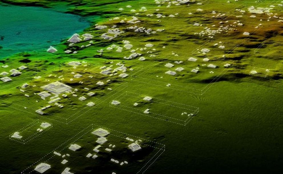
The LiDAR data also show that Maya cities were much larger than ground-based research had suggested, revealing a sprawling, complex, and interconnected pre-Columbian civilization far more advanced than most archaeologists believed. In addition to the roads, the LiDAR scans revealed more than 60,000 houses, palaces, pyramids, agricultural terraces, corrals, dikes, canals, and other man-made structures that were previously unknown.
With Global Conservation's support, scientists mapped more than 60,000 houses, palaces, canals, and other man-made structures that had previously been obscured by the thick jungle. Image courtesy Mirador Basin Project.
For decades, archaeologists considered pre-Columbian Central America to be scattered with sparsely populated city-states. Now, scientists believe that the sub-continent actually supported an advanced civilization comparable to ancient Greece or China in its influence and sophistication. They accomplished this without the wheel or beasts of burden.
Hansen and his colleagues believe the new findings may help to understand why the Mirador Basin civilization declined after 150 A.D. The collapse is being investigated by research teams from 34 universities and institutions around the world.
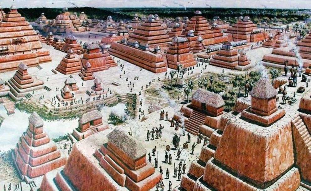
An artist's rendering of the ancient city of El Mirador.
These discoveries are also key for Mirador’s conservation: the Guatemalan Constitution’s Law for Archaeological and Cultural Heritage protects a radius of 3km around all archaeological sites and monuments. By mapping Mirador’s ancient ruins and registering these with the government, we will be able to legally protect over 90% of Mirador’s land area.
Our goal is to complete the 3D LiDAR scanning of the entire northern sector of Mirador, almost 2,000 square kilometers, which will cost approximately US$300,000. Once the mapping is complete, we will work with the Ministry of Culture and National Mapping Agency of Guatemala to formally register all archaeological sites of Mirador with the government, which will then be enforceable under Constitutional Law against any logging, looting, road building, land clearing or forest destruction.
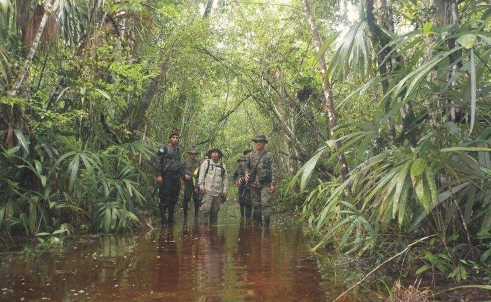
Rangers from the Mirador Park Authority are already working to implement Global Conservation's Global Park Defense and protect these wild forests and ancient ruins.
On the ground, Global Conservation is already working to secure Mirador National Park’s incredible natural and cultural heritage. In collaboration with the new Mirador Park Authority, ranger teams, and community EcoGuards, Global Conservation and its partners are mobilizing to protect Mirador against wildlife poaching, illegal logging, land clearing, looting and deforestation.