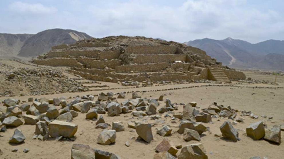
Ancient pyramid cities of Peru: A catalogue of swift decline
From 2600 BC to 1533, the legacy of the Peruvian region has revealed no end of epic tales of power, growth, unification, and demise. This is shown by the myriad of deserted pyramid cities that dot the landscape. But what if there was more to the stories? What if there was an unmentioned reason for the disappearances of ancient civilizations in that area?
Now be forewarned, what will be discussed will not be of the Promethean Nibiru lending humanity alien technology . No, what will be spoken is far worse than that. What if the mysterious disappearances of the ancient Peruvian civilizations were because of climate change?
Climate change has been connected to the collapse of several civilizations, cities, and dynasties. It has left more cultural impressions on ancient civilizations than anything else. Climate change is in the myths, in the architecture, and even in the scientific evidence. Thus, from the oldest of Peruvian civilizations to the most recent, the most famous Peruvian pyramid cities will be explored in relation to climate change.
Pyramid City of Caral
The urban complex of Caral was first discovered by Paul Kosok in 1948, and then later studied by Ruth Shady from the San Marcos University. Caral flourished between 2600 BC to roughly 1800 BC.
The Caral complex consisted of 150 acres (61 hectares) and was home to dwellings, plazas, and a 92 foot (28 meter) high temple. Its urban design was continually used by other Andean civilizations during the next 4,000 years. Caral was once a thriving metropolis which indulged in trade and ceremonial practices. The fascinating artifacts consist of a record-keeping knotted piece called a quipu, flutes made from condor and pelican bones, and cornetts constructed from the bones of deer and llamas.
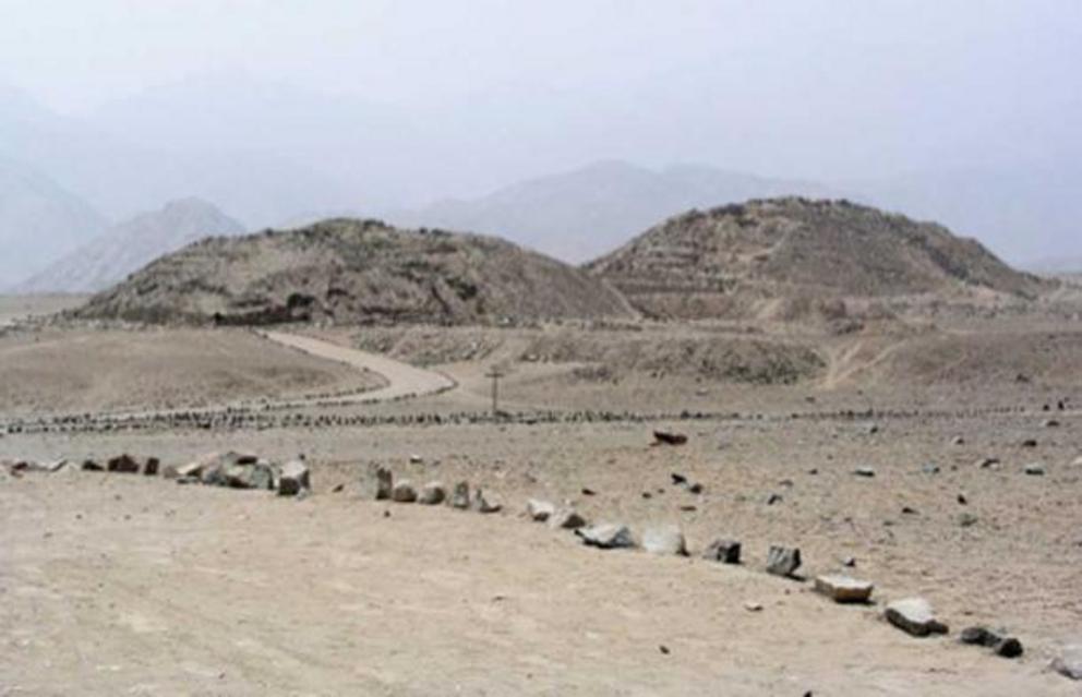
The Caral temples in the arid Supe Valley. (Xauxa / CC BY-SA 3.0 )
According to Shady’s research, Caral served as a major trade center for the region. Its depictions and artifacts consist of items from the Amazon to the high forests of the Andes. In Shady’s opinion, this productive trading environment gave rise to an elite group that did not take part in the production of food, allowing them to become priests, planners, and architects.
Therefore, the beginnings of a social structure for the Andes may have begun in Caral. Caral would create 17 more pyramids scattered across a 35 square mile (91 square kilometer) area in the Supe Valley . But then, in 1600 BC, why did the Caral civilization suddenly disappear?
Climate Change in Caral
Climate wise, during 1800 BC – 1500 BC, there was the Middle Bronze Age cold epoch, which was a period of an unusually cold environment in the North Atlantic region lasting roughly 300 years. During this time, it was believed that a series of severe volcanic eruptions occurred which could have caused significant problems globally.
According to Shady, Caral disintegrated in 1600 BC, a time right in the middle of the Bronze Age cold epoch. Archaeological evidence revealed that other nearby areas such as Chupacigarro, Lurihausi, and Miraya rose to power during Caral’s demise. Could the refugees of Caral have migrated there?
The Cahuachi Pyramid City of the Nazca
Cahuachi was considered the world’s largest Nazca ceremonial center. The excavation site is 9.7 square miles (25 square kilometers) and located 13.7 miles (22 kilometers) from the Nazca lines in Peru. It was based in the coastal area of the Central Andes in the Early Intermediate Period, 1 AD to 500 AD.
The pyramid city of Cahuachi was comprised of 40 artificially modified hills ranging between 50 feet (15 meters) and 115 feet (35 meters) in height. The main structure of the grand pyramid measured 92 feet (28 meters) in height, 361 feet (110 meters) in length, and 328 feet (100 meters) in width. It included seven levels, adobe walls, and geometric ramps.
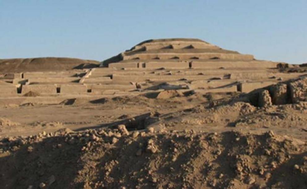
Archaeological site of Cahuachi showing the grand pyramid. (Ed88 / CC BY-SA 3.0 )
Cahuachi also contained walled enclosures and separate facilities consisting of a compound with a permanent mound. The platforms were adobe facades encasing trash piled up over hills. The trash heaps contained abundantly decorated shards, remnants of ritual feasting, and worn-out textiles.
According to the works of Italian archaeologist Guiseppe Orefici and American archaeologist Helaine Silverman, recent evidence suggests Cahuachi might have been a center for religious pilgrimage. Though the site appears to have been used until 500 AD, pilgrimages dwindled until people stopped going. So, what happened?
Climate Change of Cahuachi Seen Through Genetic Testing
A team of Italian archaeologists led by Nicola Masini and Rosa Lasaponara used remote sensing satellite technology and discovered that between 300 AD and 350 AD, two natural disasters occurred. The first was a mighty flood and the second was a devastating earthquake which hit Cahuachi.
In the eyes of the Nazca, the site might have lost its sacred powers and that is why it was abandoned. But could there be genetic evidence to answer their disappearance?
Anthropologist Lars Fehren-Schmits and colleagues gathered mitochondrial DNA samples from 207 mummified remains in Peru’s Rio Grande de Nazca region. The researchers felt these were a good sample representation of Andean populations from 840 BC to 1450 AD. Schmit’s team discovered by around 665 AD, about 10% of the Nazca population moved into the highland region and interbred with the local people.
La Huaca de La Luna and La Huaca de La Sol
The Moche civilization’s best-known remains are two giant structures known as the Temple of the Sun ( Huaca del Sol ) and the Temple of the Moon ( Huaca de la Luna ). Both sites are located near Trujillo in the Moche River Valley where the civilization prospered between 100 AD to 900 AD.
Huaca del Sol has a giant causeway leading to a stepped pyramid; however, it was partially destroyed and looted by Spanish conquistadors in the 17th century. It is believed that Huaca del Sol served as an administrative, military, and residential function, as well as highly elite Moche burial ground.
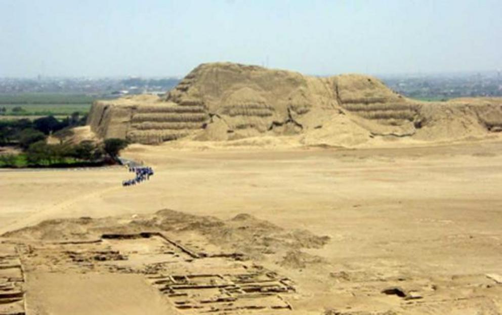
Huaca del Sol as seen from the southeast, with the Moche River delta beyond and city ruins in the foreground. (Gustavo M / CC BY-SA 2.0 )
However, Huaca de la Luna served primarily as a ceremonial and religious function. Huaca del Sol’s dimensions were 1,116 feet (340 meters) by 136 feet (41 meters). At its base, it stood 136 feet (41 meters) high. A short distance away from it is Huaca de La Luna, which is a terraced platform built against a hillside.
Huaca de la Luna consisted of three main platforms which served different functions. The northernmost platform was once decorated with murals. The central platforms are believed to have been used for Moche elite burials.
The eastern platform was designated for human rituals. After sacrifice, the bodies of the victims were hurled over the side and left exposed on the patios. Excavations have revealed multiple adult male skeletal remains showing signs of trauma, usually a severe blow to the head, as the cause of death.
Within these platforms are rooms, currently being excavated, which have an inverted pyramid design, with levels becoming gradually smaller as they descend. The hillside was capped with large rooms and courtyards. Surrounding these two sites were several hundred meters of archaeological evidence revealing dense populations.
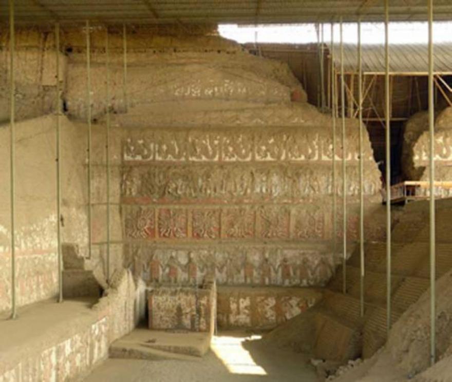
The main mural of the Huaca de la Luna. (S23678 / CC BY-SA 3.0 )
Researchers believe that this was indicative of the area being a major Moche city. However, even as a sophisticated and densely populated culture such as the Moche civilization, why did they disappear?
Climate Change in La Huaca de la Luna and La Huaca de la Sol
Researchers believe that around 880 AD a disastrous drought began and lasted for at least 100 years. This corresponds to the decline of the Wari, the Tiwanaku, and most likely the Moche as well. The Moche may have succumbed to the same fate as many other civilizations in that region: Earthquakes, prolonged drought, and catastrophic flooding arising from the El Nino climatic anomalies.
Huaca Huallamarca in Lima and Huaca Pucllana
Lima culture thrived in the Peruvian central coast between the years of 200 AD and 700 AD. They overlapped with the Paracas, Moche, Nazca, and Wari cultures. Near the end of their era, they were heavily influenced by the Wari (500 AD- 900 AD).
Huaca Huallamarca is currently a museum and excavation site in the district of San Isidro in the city of Lima. Excavations of the site began in 1942 by archaeologist Julio C. Tello. In 1958 a team of researchers discovered 48 funeral bundles massed on top of the pyramid. Researchers believe that the Huaca Huallamarca pyramid was an official site and a cemetery from between 200 AD to 1532 AD.
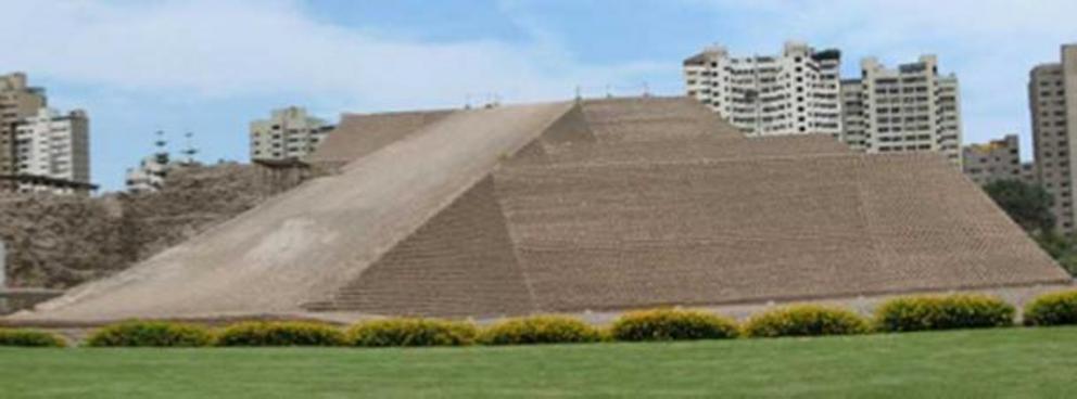
Huallamarca archaeological site / pyramid in Lima, Peru. (AgainErick / CC BY-SA 3.0 )
Along with the mummies, ceramic pots from the Lima culture were unearthed. Textiles were also found along with wind instruments. Unlike most other pyramids that have been excavated and explored in the Andes, a majority of Huaca Huallamarca has been recently reconstructed.
In another area, Huaca Pucllana Juliana is an adobe clay pyramid located in the Miraflores district of central Lima, Peru. It was built from seven staggered platforms and most likely served as an important ceremonial and administrative center for the Lima culture. Its purpose might have been to house elite clergymen and enforce complete religious and political power over the natural water resources of the area.
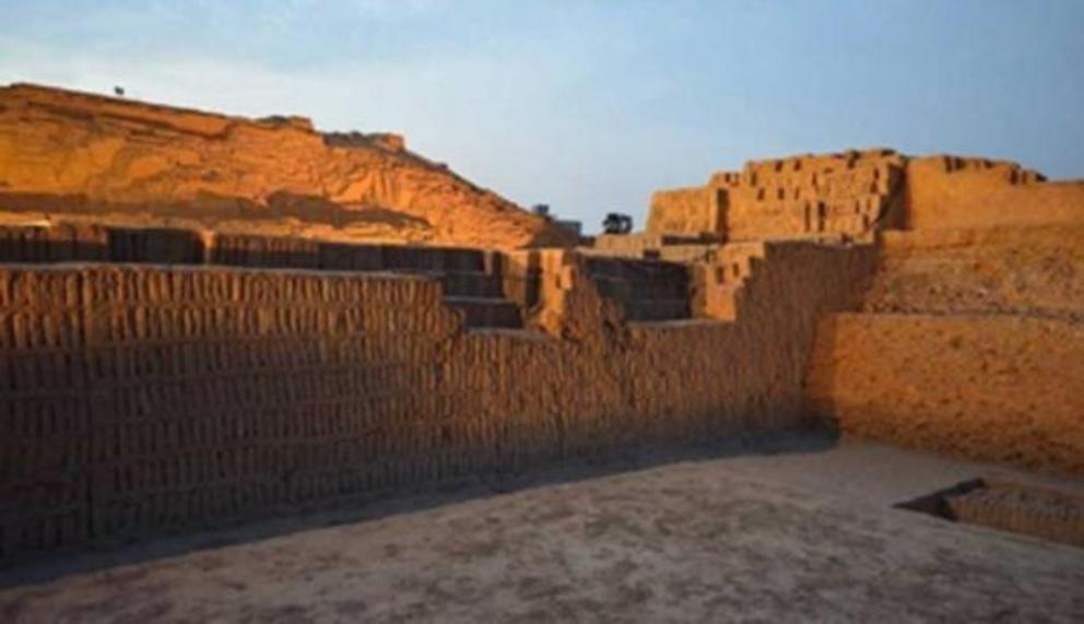
Huaca Pucllana. (Andrearubin / CC BY-SA 3.0 )
The structure is surrounded by a plaza and a town square. A structured wall exists dividing the area into two separate sections. The first section contains benches and deep pits intended for fish and marine life offerings to the gods. The second section was most likely an administrative place due to the presence of small clay figurines and habitable structures made from adobe.
Climate Change and the Decline of Lima
French-led scientists examined a 26 feet (8 meters) long mud core taken from a Peruvian lake. From their findings, archaeologists and fellow researchers now have convincing proof of a worsening environment that led to the disappearance of many of the Andean civilizations.
Currently, it is believed that around 600 AD, the climatic and environmental changes in the Andean region were brought about by cycles of droughts and the El Nino phenomena. All cultures were affected.
With the change of rainfall and water availability, massive populations migrated to other regions. Crops died and adobe dwellings crumbled. The people of the Lima region, as well as many others slowly dispersed across Peru hoping to find better living situations.
The Pyramids of the Lambayeque Valley
The valley of Lambayeque is well known for its scores of human-made canals and many abandoned pyramid settlements. But there is none more famous than the Tucume site in Peru.
Tucume is located south of the La Leche River around the La Raya mountain plain. It stretched across 547 acres (221.5 hectares) and was entirely built from mud brick. It was made by the Lambayeque people (also known as the Sican) in the middle of the 10th century.
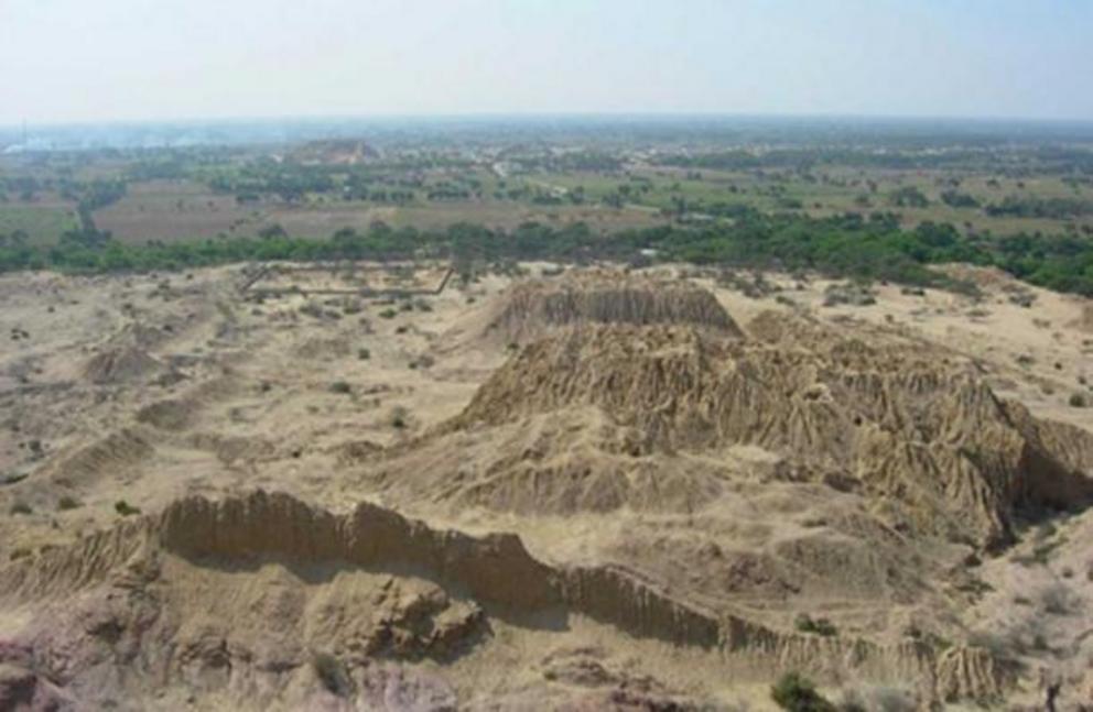
The Túcume mounds are composed of a complex of 26 pyramids. (Leoboudv / CC BY-SA 2.0 )
In 1100 AD, Tucume was used by three consecutive cultures over 500 years. It contains an array of structures of varying sizes. It has the highest concentration of monumental architecture as well as 26 enormous truncated adobe pyramids thought to have been created through the centuries.
Its architecture saw renovations from the Chimu in the 14th century, then from the Inca in the 15th century, and finally, was looted by Pizarro in the 16th century. However, the folk legends of the region are just as intriguing as the architecture itself.
Brief Legend of the Lambayeque
Cabello Balboa wrote a chronicle in 1586 about the Lambayeque origins. A small fleet of Balsa rafts, led by Lord Naylamp, arrived at the beaches of San Jose cove. Lord Naylamp was accompanied by nine foreign warriors, a green statue which carried the name Yampallec, his wife, several of his harem, and 40 other dignitaries.
Naymlap then built a palace as well as a center of devotion for the green statue of Yampallec at a place called Chot. Twelve generations ruled until King Fempellec, who was tempted and then cursed by a sorceress, accidentally brought 30 days of disastrous rain and devastating floods, followed by famine and pestilence.
Though there is no substantial archaeological evidence, this legend describes the world after the abandonment of the Moche which loosely correlates with the early phase of the Sican between 700 AD and 900 AD.
With the absence of the Moche, coastal communities from the south may have moved up into the valley. With constant occupation, and various migrations of people, could there be more to say about what might have caused such turbulence in this area?
The Ghost Pyramids of the Lambayeque Valley
In Chile, in a 1,500 year old lakebed sediment core as well as one from the Eastern Cordillera of Ecuador were analyzed and gave some impressive results. The cores revealed a significant climate anomaly from 950 AD to 1250 AD in which the tropical Pacific became colder.
It is also known that the later part of this state’s 11th to 15th-century existence was full of destabilizing events such as warfare and a dramatic increase in human sacrifice. Could the climate be the reason for this? There was also evidence of a possible backward migration from the highlands to the coast during a period of drought in the 1200s AD.
Closing Thoughts on Climate Change as the Reason for Civilizations’ Demise
Climate change has been linked to human migration from the beginnings of humanity all the way to contemporary times. Its effects can be felt over resources and living conditions to the point that almost no civilization is able to endure. Could Peru be a necropolis dedicated to climate change's results? Or could it all be nothing more than conjecture? Perhaps further analysis of climate change can help in understanding what happened to other empires in the Americas.
Top image: Caral, UNESCO world heritage site and the most ancient city in the Americas. Source: Mark / Adobe Stock.

