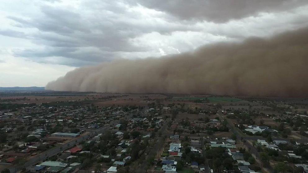
Huge dust storms in Australia hit central New South Wales
Videos posted to social media show the clouds turning day into night in some areas
Drone footage shows massive dust storm sweeping across central New South Wales – video.
Damaging winds produced by thunderstorms across central New South Wales have whipped up dust storms that turned daytime into night in some towns.
The Bureau of Meteorology issued a series of severe thunderstorm warnings on Sunday evening for inland NSW with the associated winds generating massive dust clouds.
Videos posted to social media showed dust storms descending on Dubbo and nearby towns that were so thick they blocked out the sun.
A gust of 94 km/h was recorded at Parkes about 6.30pm while a gust of 107 km/h was recorded at Dubbo about 7.45pm, the bureau said.
A bureau meteorologist, Rose Barr, said Sunday’s significant rain was concentrated across central and northern parts of the state on, and east, of the ranges.
Rain and hail also lashed Victoria, sparking almost 1500 calls for assistance with more severe weather on the way as bushfires continue. The State Emergency Service received 1453 calls for assistance since Sunday morning, more than 1000 of them for building damage.
Many towns on the NSW mid-north coast and the northern rivers regions received between 100mm and 180mm from 9am to 10.30pm on Sunday.
In the southern part of the state, high winds saw storms race overhead quickly, resulting in lower measured falls.
Downpours over the past few days have provided relief for parts of drought-stricken NSW and helped firefighters slow the spread of bushfires and build containment lines before increased fire danger mid-week.
In Victoria, rain fell hardest in East Gippsland, with 56.6mm falling at Mount Elizabeth and 55mm at Mount Wellington.
In Melbourne, the northeast and inner east were hit with severe thunderstorms, including giant hail. Most areas copped between 10 and 15mm of rain, while Doncaster received 27mm.
The thunderstorms will continue on Monday. “Tomorrow we have a very active thunderstorm day forecast, particularly across south-eastern and central-eastern parts of [NSW], as well as parts of the south-west slopes,” Barr said.
But again they were likely to move quickly with some “extremely strong wind gusts”. There could also be large hailstones.
There are 14 bushfires still burning in Victoria, mostly at an advice level.
An emergency warning was issued on Sunday evening for a bushfire in central Victoria threatening lives and homes in Pastoria, but it was downgraded to a “watch and act” early on Monday.
As the effort to put out the remaining fires continues, a severe weather warning is in place for central and eastern parts of the state, including fire-ravaged East Gippsland.
Widespread falls of between 10 and 30mm are expected, but some areas could see isolated totals of up to 80mm or 100mm.
The wet conditions could lead to flash flooding in some areas, but the weather bureau says rainfall is unlikely to put out remaining blazes.
The weather comes as up to 70 people are preparing to return to Mallacoota on Monday, where bushfires had trapped thousands on the beach.
Victorian emergency services minister Lisa Neville says people who were reuniting with family members that stayed in the stranded East Gippsland coastal town were the priority.
“300 people want to fly back in and that’ll be our first priority and we’re looking at around 70 people to fly back in (Monday),” Neville said.
Winds will shift and come more from the north and west midweek, bringing drier and warmer air on Wednesday and Thursday. “That means on both of those days we may end up seeing fire dangers increasing again and causing more problems for our fire agencies,” Barr said.
But moisture will return on Friday and the weekend.
For the rest of this article please go to source link below.

